
Emergency Planning Zones
A keystone of any plant's preplanned protective action strategy involves two emergency planning zones (EPZs) around the plant. The EPZ's size and shape vary for each plant due to detailed consideration of the specific site conditions, unique geographical features of the area, and demographic information. EPZ-specific strategies provide a strong starting point for implementing additional measures beyond the planning zone, if extremely unlikely events unfold.
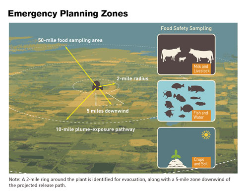
The two EPZs are described as follows:
Plume Exposure Pathway EPZ
The first EPZ is a plume exposure pathway extending about 10 miles in radius around the reactor site. Protective action plans within this area are designed to avoid or reduce dose from potential exposures such as inhaling radioactive particles. These actions include sheltering, evacuation, and the use of potassium iodide pills where appropriate.
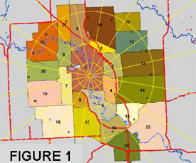
Typical 10-Mile Plume Exposure Pathway EPZ Map
Ingestion Exposure Pathway EPZ
The second EPZ is an ingestion exposure pathway extending about 50 miles in radius around the reactor site. Protective action plans for this area are designed to avoid or reduce dose from eating or drinking radioactive materials. These actions include a ban of contaminated food and water.
Page Last Reviewed/Updated Wednesday, August 28, 2024
Page Last Reviewed/Updated Wednesday, August 28, 2024