
Pathfinder - Lucky Mc (Gas Hills North)
1.0 General Site Information
| Site Location: | Gas Hills Mining District, WY | |
| Former NRC License No.: | SUA-672 | |
| NRC Docket No.: | 40-2259 | |
| Agreement State Contact: | Charlee Bolger | 307-777-7757 |
| NRC Agreement State Site Monitor: | Allyce Bolger | Allyce.Bolger@nrc.gov |
| NRC Site Monitor: | Thomas Lancaster | Thomas.Lancaster@nrc.gov |
2.0 Site Description
The Lucky Mc site is located in west central Wyoming in the Gas Hills region in Fremont County, Wyoming. The site is about 45 miles southeast of Riverton, Wyoming (Figure 1).
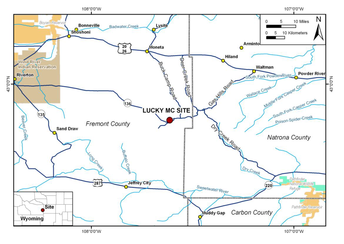
Figure 1. Lucky Mc Uranium Mill Site Location Map
3.0 Site History
Uranium milling began at this site in 1958 and continued through 1988 with a total of 12 million tons of ore processed. The mill utilized a conventional acid leach process. The facility area included approximately 56 acres for the mill, 241 acres for the post-reclamation tailings piles, 1,276 acres for the disposal site, and 6 tailings ponds (Figure 2). The mill was demolished and placed in the outslope of the No. 2 Tailings Dam, with a clay-radon barrier placed over the material. The mill area includes approximately 56 acres. The site has three solid tailings impoundments and three tailings solution ponds. The post-reclamation tailings piles cover approximately 241 acres.
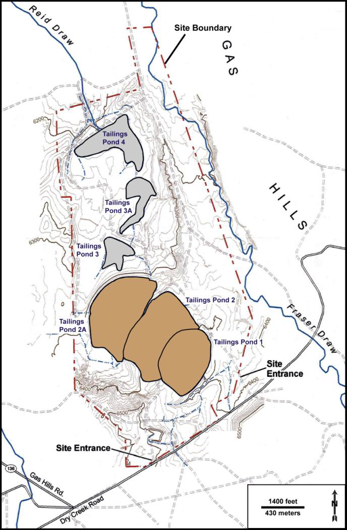
Figure 2. Lucky Mc Site Layout Source: U.S. Department of Energy. “Long-Term Surveillance Plan for the Gas Hills North UMTRCA Title II Disposal Site, Fremont County, Wyoming.” Grand Junction, Colorado: U.S. Department of Energy. 2009.
The Construction Completion Report was submitted to the NRC on April 21, 2005. NRC staff approved the Construction Completion Report in October 2006. NRC staff approved an amendment request to remove two offsite wells (AL-8 and AL-9) from the approved groundwater monitoring network. The license amendment was issued 6/2008. In February 2009, NRC staff received for review, the DOE Long-Term Surveillance Plan (LTSP) for the Gas Hills North Site (Pathfinder-Lucky Mc) dated January 2009. The LTSP explains how DOE will fulfill requirements as the long term custodian of the Gas Hills North Site, including inspecting, monitoring, conducting maintenance, fulfilling annual and other reporting requirements, and maintaining records pertaining to the site.
Tailings Management and Disposal
The former tailings system consisted of a series of earthen embankments across Reid Draw, extending over 2 miles down the draw (Figure 2). The upper portion of the tailings system included Tailings Ponds 1, 2, and 2A, which were located immediately north of the former mill and contained all of the solid tailings generated at the site. Further downgradient and north of the solid tailings pond were three solution ponds (Tailings Ponds 3, 3A, and 4) that held the barren solution (recoverable uranium had been removed) that was generally not recycled through the mill. This solution had low pH (2.0–3.0) and contained high concentrations of dissolved solids (including various heavy metals) and radionuclides such as thorium-230 and radium-226. In addition, a temporary pond was used as a pump back treatment system for receiving solutions from excursion well cleanup and groundwater sweep, surface water runoff, and solution water for construction and dust control within the cells. On December 20, 2002, alternate concentration limits were approved for the Lucky Mc site, and all mill tailings reclamation was completed on December 14, 2004.
4.0 Current NRC actions/status
NRC currently has no actions for the site until the CRR is submitted by the State of Wyoming.
5.0 Expected Transition to DOE for LTS&M
2029 (See DOE LM Site Management Guide, June 2022)
Page Last Reviewed/Updated Tuesday, May 12, 2026
Page Last Reviewed/Updated Tuesday, May 12, 2026